
Precision Aerial Surveys, Photography, and Videography
Arizona Aerial Intelligence
For any aerial survey requirement across Arizona, Phoenix Helicopter Charters offers comprehensive solutions. Our capabilities include magnetometer and electromagnetic surveys, LiDAR data acquisition, and advanced GIS mapping, leveraging the helicopter's unique low-altitude flight and hover characteristics for superior data collection. We also provide specialized aerial filming services, deploying advanced cinematography and photography platforms. This includes options for door-off configurations for precision handheld work. For unparalleled aerial perspectives across Phoenix, Scottsdale, or rural Arizona, our diverse options ensure your project's technical specifications are met with precision.
Aerial
Surveys
LiDAR, GIS Maps, FLIR, HD Video & More
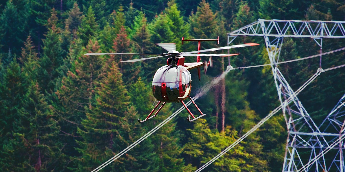
Phoenix Helicopter Charters provides critical support for infrastructure management across Arizona. From detailed pipeline surveys and Right-of-Way inspections to transmission line patrols, we provision the appropriate aircraft and specialized equipment. This ensures your projects are executed with precision, maintaining operational integrity and meeting all technical specifications.
High Tech Results
The Top Pilots in Arizona, Today's Technology... Maximum Results.
Call 1-866-826-4826 Now!
Phoenix Helicopter Charters provides the tools needed to complete your land surveys, utilizing the right equipment to provide the aerial photos that are often needed.
Effective aerial surveys are fundamental for precise Right-of-Way and site inspections, accurate topographical data acquisition, and high-definition imagery for commercial projects in Arizona. Helicopter surveys offer the optimal method to assess the diverse Arizona terrain, identify pipeline anomalies, detect issues within transmission lines, or conduct property evaluations. Phoenix Helicopter Charters specializes in developing custom photographic and remote sensing operations. These solutions are meticulously designed to maximize technical efficiency, fiscal responsibility, and deliver superior results for your specific objectives.
The operational characteristics of a helicopter make it the premier platform for intricate aerial surveying. Unlike fixed-wing aircraft, which the FAA mandates maintain a minimum altitude of 1,000 feet above obstacles, helicopters possess the unique capability to operate at significantly lower altitudes. This allows for unparalleled precision in data capture and direct visual inspection. Furthermore, helicopters can safely access and survey challenging or hazardous zones, providing engineers with critical vantage points otherwise unattainable through conventional methods.
There is no better way to conduct your visual survey, animal population counts, soil drainage analysis, ROW inspections, pipeline and transmission line inspections, and geographical surveys.
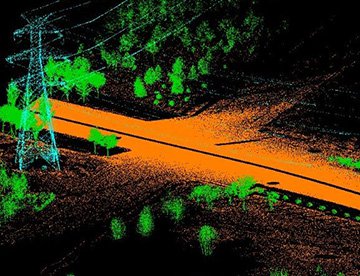
LiDAR Imaging
Light Detection and Ranging, or LiDAR, is a remote sensing method used to examine and measure Arizona topography as well as objects, like vegetation, upon it.
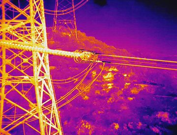
Infrared Imaging
Thermographic IR cameras are used to detect radiation in the long-infrared range of the electromagnetic spectrum and produce images of that radiation, called thermograms.
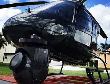
HD Video Gimbal Capture
Modern HD and 4K cameras can be mounted to helicopters, using the proper STCs, with a gimbal to stabilize photos & videos for detailed results.
Advanced Aerial Filming and High-Resolution Videography
For expert camera work in the Phoenix Sky
Get a Fast, free QuotePhoenix Aerial Cinematography
Phoenix Helicopter Charters provides comprehensive access to professional-grade aerial cinematography resources throughout Arizona. We provision advanced technology for custom shoots, deploying gyro-stabilized camera platforms such as Tyler Mounts, Wesscam, Cineflex, Pictorvision, and SpaceCam. These integrate with high-end cameras, including Cineflex HD, RED Epic, and Arri Alexa, alongside 3D and experimental systems. Our services support all aspects of your production goals, from air-to-air to ground-to-air shots, ensuring exceptional visual outcomes in collaboration with your aerial Directors of Photography and directors. Specializing in helicopter services for both still and motion photography, Phoenix Helicopter Charters supports nearly every media-related operation across the state, from Phoenix to Tucson and Flagstaff. This includes film productions, television series, documentaries, promotional videos, commercials, and aerial props. We also facilitate critical relief work for broadcast networks and provide extensive coverage for major historical and sporting events, leveraging a diverse fleet of helicopters to meet diverse production demands.
Call Us Today at 1-866-826-4826 for a Free Quote
Contact Us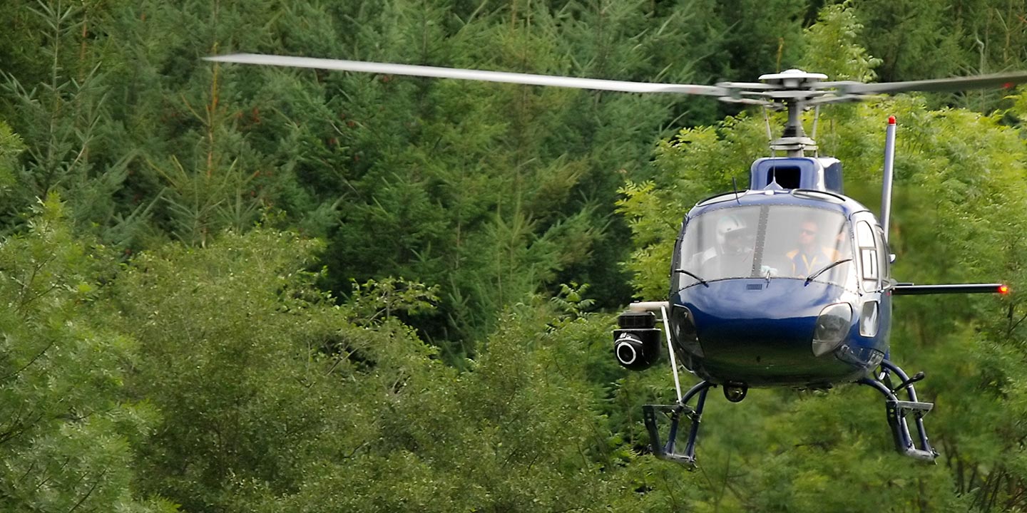
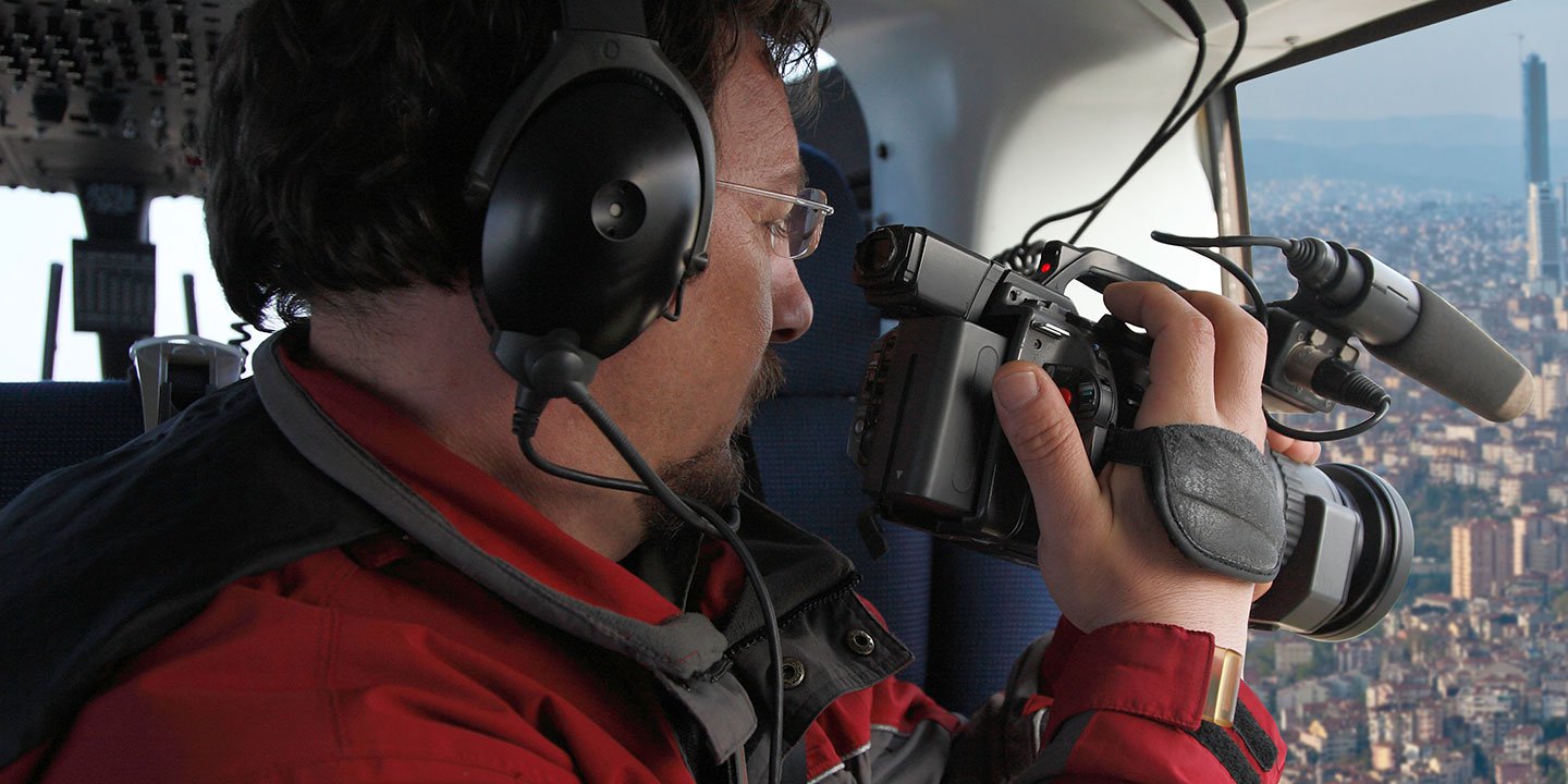
Aerial Photos
Hand-held or Mounted OpTions in Phoenix
We will help you get the right equipment for your aerial photography project! Call 1-866-826-4826 today to get a fast, free quote.
The Most Options for Photography
Arizona's unique landscapes demand precision aerial photography for commercial and technical applications. Phoenix Helicopter Charters specializes in providing professional aerial photography charters designed to meet stringent specifications and capture exact visual requirements. We offer cost-effective photographic opportunities across Arizona, ensuring high-quality imagery for diverse projects. For handheld projects, many helicopters can be configured with door removal. For enhanced stability and precision, we encourage inquiries regarding advanced gyro-stabilized mount systems to achieve optimal results.
Superior Service
Every one of our customers gets a dedicated helicopter expert to assist with flight plans, tech loadouts, production logistics, project schedules, and other demands.
Over 500 Aircraft
Our network of direct air partners extends well beyond Phoenix, Arizona. This allows us to offer a wide range of solutions for even the most sophisticated projects.
The Best Equipment
From high-tech sensors like LiDAR, FLIR, and GIS to HD cameras and movie production gimbals, we're here to make your job as easy as possible.


